Introduction
CLIMATE science IN ANTARCTICA
For many years, the majority of Antarctic science took place on national Antarctic expeditions, whose primary objective was not science but exploration. Small groups of researchers traveled with the explorers, often on wooden ships, completely cut off from the outside world. When they arrived in the Southern Ocean they lowered buckets into the sea to study the water. In Antarctica they observed the wildlife and the movement of glaciers, creating invaluable records for scientists today.
Early science in Antarctica was constrained by the vastness and inaccessibility of the landscape – both of which made conducting research near-impossible – and the limitations of technology at the time.
Antarctic science today
CLIMATE science IN ANTARCTICA
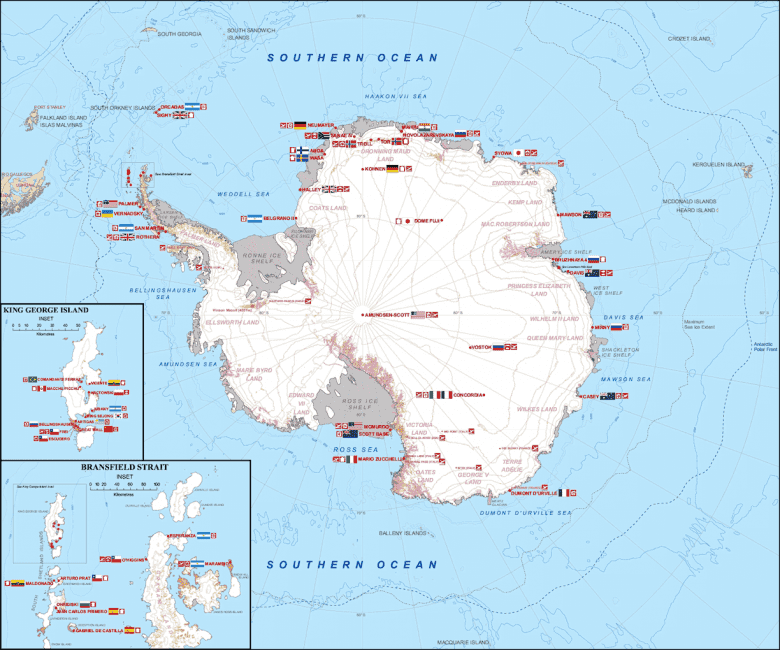
Much has changed since the early days of Antarctic research. Today, most Antarctic science takes place on national Antarctic research bases, or stations, which are scattered across the Antarctic continent. There are around 80 scientific bases across Antarctica, operated by around 30 different countries. Scientists of all nationalities collaborate, sharing resources and data to achieve the best possible research outcomes for all nations.
New technologies like underwater robots and ground-penetrating radar are giving Antarctic climate scientists unprecedented access to the most remote places on earth without even leaving the office.

CLIMATE SCIENCE IN ANTARCTICA
Globally important research
Scientists have long recognised that Antarctica has great significance for all of humanity due to the unique role it plays in regulating the global climate and ocean currents.
Today they are uncovering critical insights into the ocean, ice and the global climate: past, present and future.
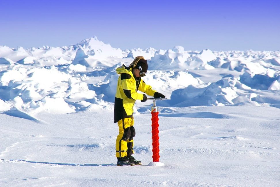
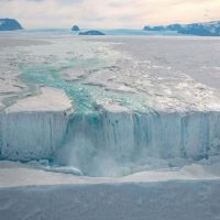
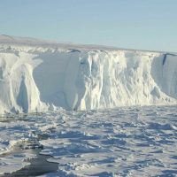
Studying the Ice Sheet
CLIMATE science IN ANTARCTICA
Of all the work sites on earth, the Antarctic Ice Sheet must be the most remote, frigid and grueling. While some glacial research is still conducted from field stations in Antarctica, new remote sensing technologies are allowing researchers to see the ice from afar like never before.
Satellite technology has come a long way since the launch of Sputnik 1 signaled the age of aerial research in 1957. In recent decades, highly sensitive satellites have revolutionized the study of ice sheets, providing information on rate of flow, mass and surface height over vast areas.
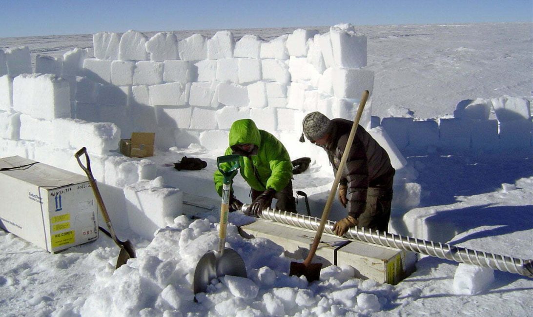
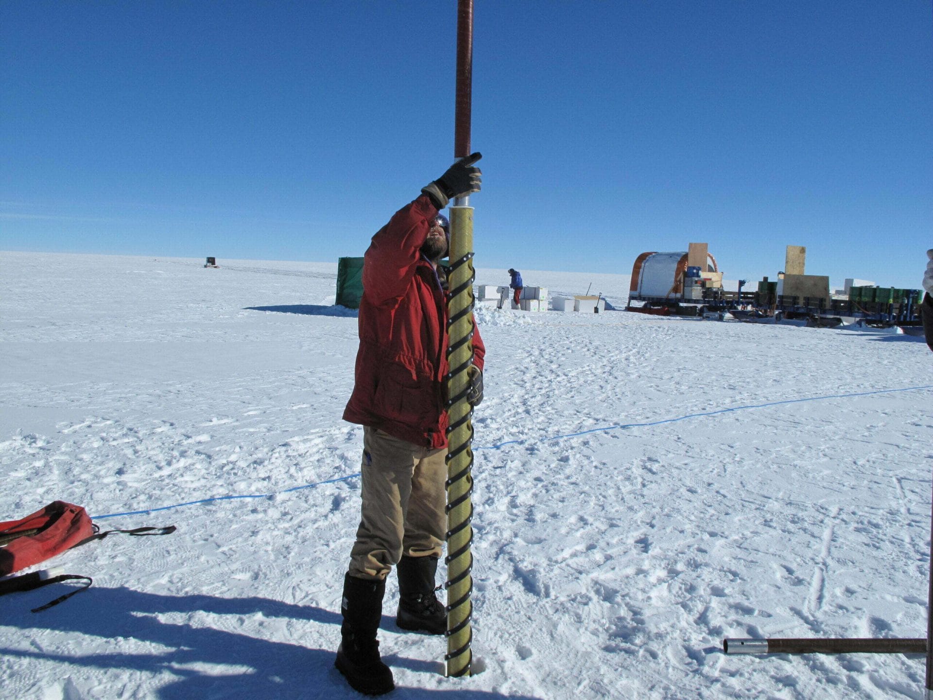
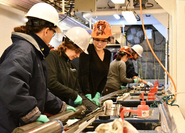
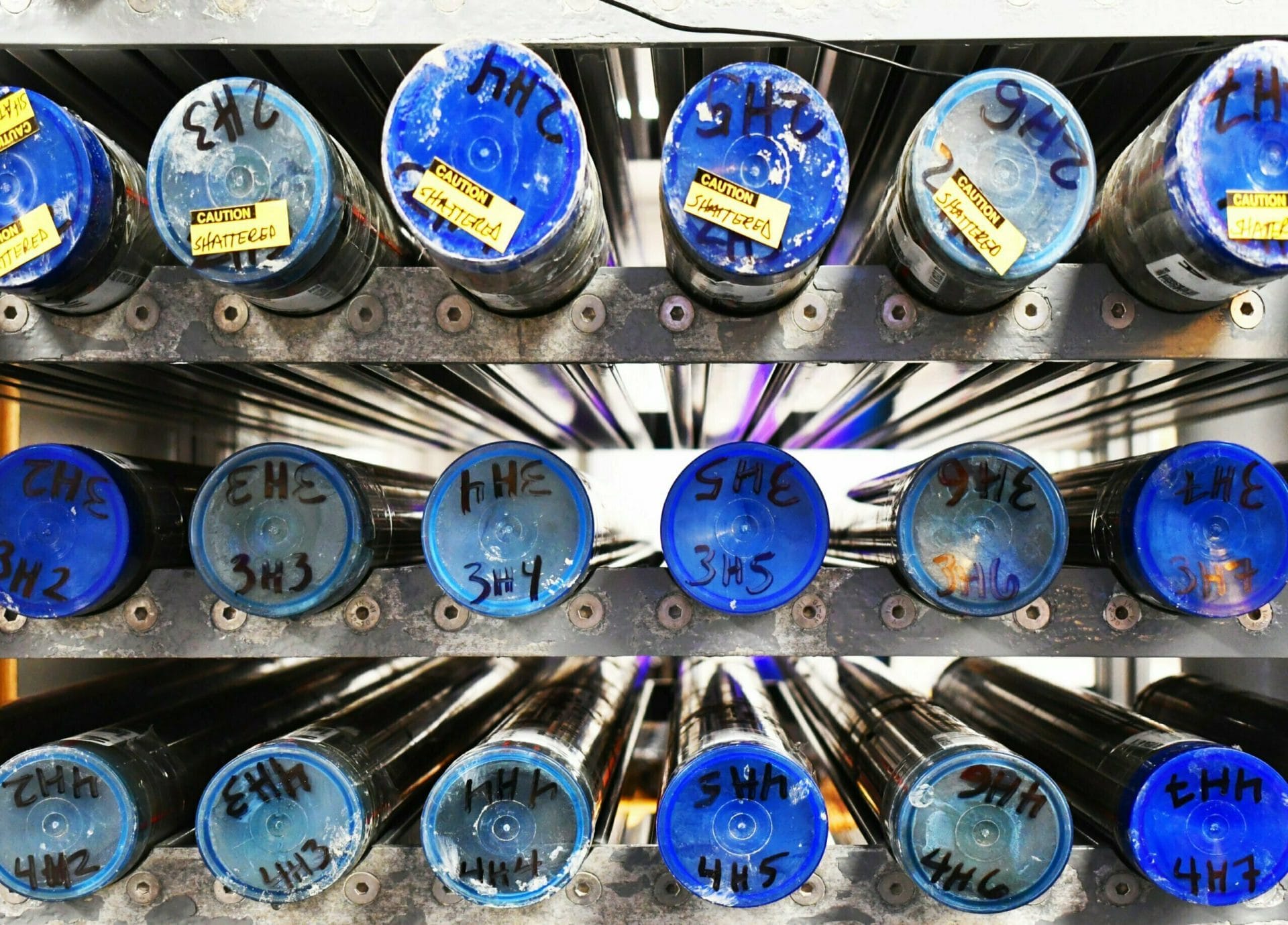
Studying ice cores
SECRETS IN THE ICE
While the surface and motion of the ice sheet reveals how it is changing today, the ice itself holds clues to the Earth’s climate in the past.
The Antarctic Ice Sheet is several miles thick. It formed over millions of years as layer upon layer of snow fell on the frigid continent, gradually building up and hardening into ice. As it hardened, small pockets of air were trapped in the icy matrix.
By drilling down into the ice sheet, scientists pass through layers of time and into the atmosphere of the past.
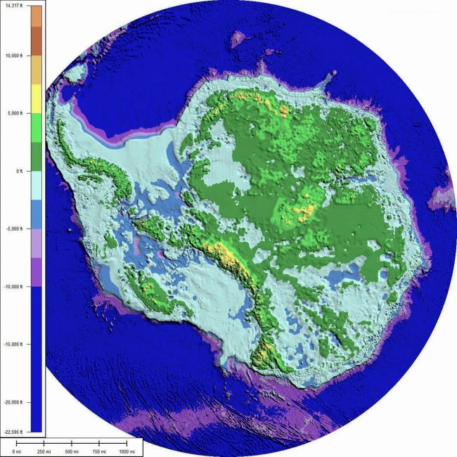
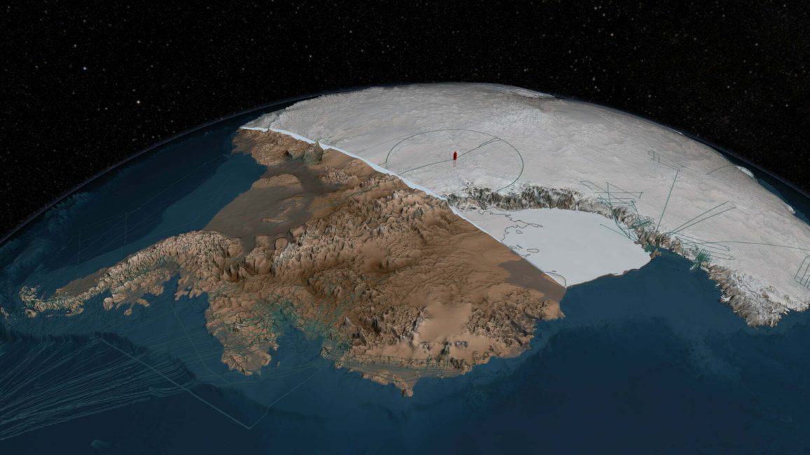
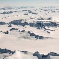
The shape of Antarctica
UNDER THE ICE SHEET
The question of what lies beneath the ice has puzzled researchers for centuries. Today, technologies such as ground-penetrating radar are allowing glaciologists to peer under the ice sheet and map the Antarctic bedrock below.
Ground-penetrating radar (GPR) sends a pulse through the ice, penetrating hundreds of feet to where the ice meets ocean or bedrock. The GPR sends that information back to the surface in the form of an electromagnetic signal. By decoding this information, scientists can map out the depth of the ice, and the shape of the land below.
Prior to the use of GPR, scientists thought there was a whole continent buried under the ice. Recent studies have revealed that under the ice, Antarctica is a complex arrangement of mountain ranges, ancient continental land, volcanic arcs and islands. West Antarctica is an archipelago surrounded by ocean, while East Antarctica is an amalgam of prehistoric land masses, including the deepest canyon on earth.
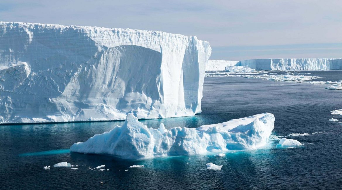
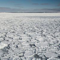
Studying the Ocean
CLIMATE science IN ANTARCTICA
The depth and magnitude of the Southern Ocean, along with frequent strong winds and large swells make it extremely difficult to study. The traditional method of taking samples manually from vessels was a time-consuming, resource-intensive and very slow way to gather important data about the Southern Ocean.
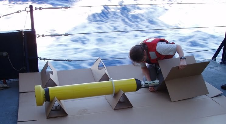
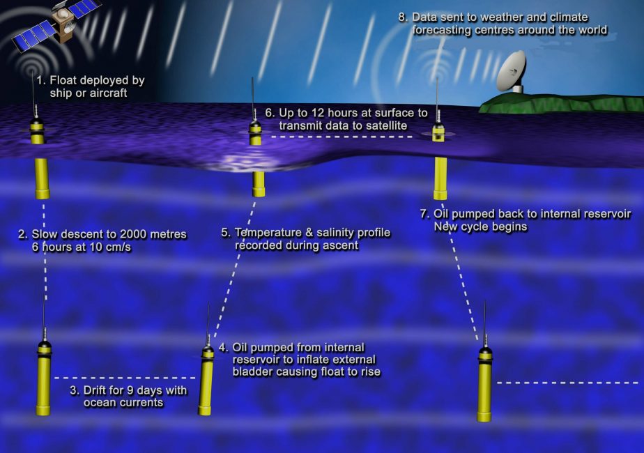
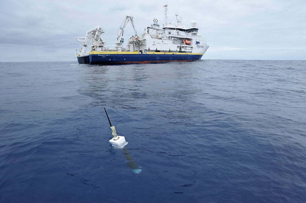
As with Antarctic ice, advancements in remote technologies are providing researchers with previously unimaginable access to the global ocean. One of the most exciting pieces of technology in the study of oceanography is automated robots such as Argo floats.
Studying the Ocean
CLIMATE science IN ANTARCTICA
Argo is an international program, and Argo floats have been deployed across the global ocean to gather information about how the ocean influences the climate. These small robotic instruments descend and rise through the water column, gathering information about the water temperature, salinity and pressure on their way. Each time the float returns to the surface (usually every 10 days) it connects with a GPS or satellite to upload the data it’s received, and download instructions for its next dive.
The Argo program is providing oceanographers with valuable insights into the properties of the ocean in different regions and at different depths. By understanding how the oceans work, they are better able to model how changes in the ocean, particularly increased heat content, will affect global sea levels and the climate in general.
The ocean under the Ice
CLIMATE science IN ANTARCTICA
While Argo floats range across the ocean, other highly specialized autonomous underwater vehicles (UAVs) have been designed to venture under floating ice, into parts of the ocean where no human has been before.
The Icefin is a hybrid UAV, controlled remotely by operators above the ice. It drifts underwater, measuring the properties of the ocean and exploring the seafloor. It also allows scientists a close-up view of the underside of glaciers, to help them better understand the forces that drive their movement.
While the Icefin is already providing incredible insights into the watery world under the ice, NASA hopes similar technologies will be used one day to explore the ice-covered oceans on Europa, a moon of Jupiter.
KEEP LEARNING
Related reading
Scientific consultation: Nicholas Golledge, Professor of Glaciology at Victoria University of Wellington.
Now that you’ve learned a little about how Antarctic researchers study the climate in Antarctica and the Southern Ocean, read on to learn more about extraordinary Antarctica.
Climate Crisis in Antarctica
FEATURED LEARNING